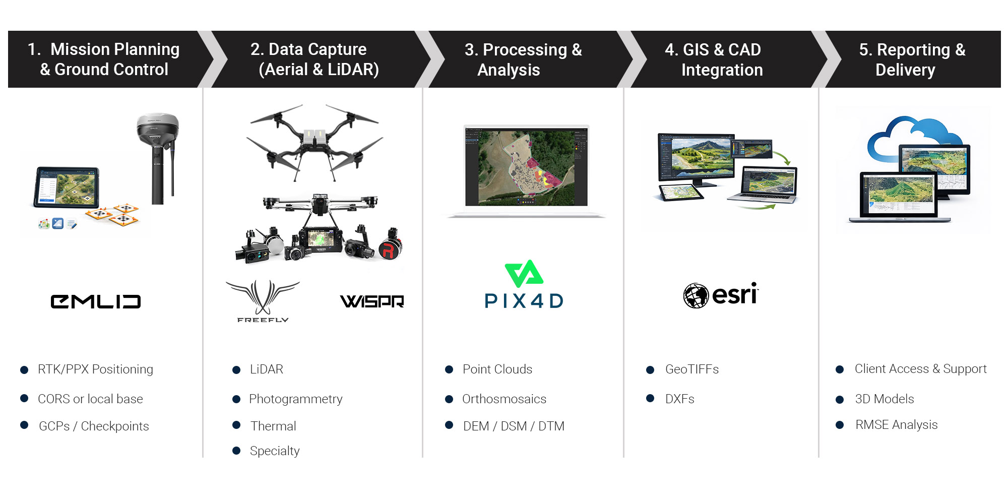
Geospatial Solutions
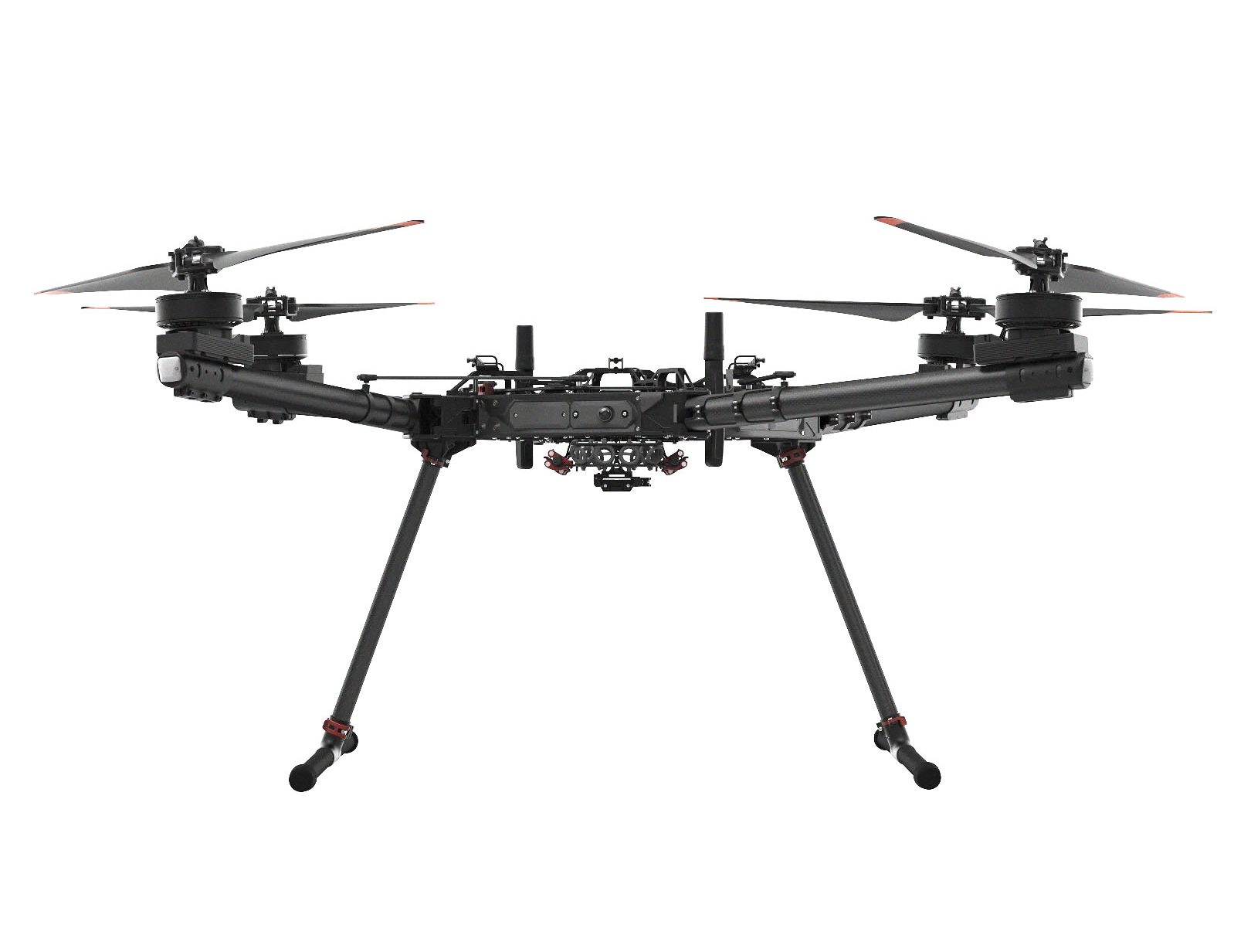
FreeFly
Industrial Blue approved drones with high Payload capability
Freefly Astro UAV delivers smooth, reliable performance with precise flight control and ample payload capacity, making it well-suited for professional aerial data capture and inspection missions

WISPR
Drone platforms for mapping, surveying, construction and power line inspection
The WISPR SkyScout 2 combines lightweight construction with agile, stable flight performance, enabling efficient deployment and reliable aerial data capture in a highly portable platform.
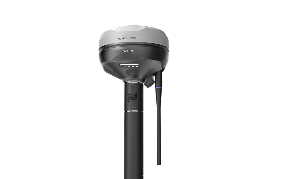
Emlid
High-precision RTK GNSS receivers and software
The Emlid RS4 Pro delivers fast, centimeter-level positioning with reliable multi-band GNSS performance, providing robust accuracy and stability for demanding surveying and mapping applications.
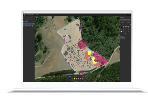
Pix4D
Software tools for terrestrial and drone surveying, photogrammetry and CAD
Delivers reliable, high-accuracy photogrammetry performance with efficient processing workflows, producing consistent, survey-grade outputs from aerial and terrestrial imagery.
From accurate data capture to enterprise GIS insights, we provide a complete drone-to-decision workflow using best-in-class technologies
End-to-End Workflow for Generating Integrated Above- and Below-Ground Digital Twin Models
Payloads
FLUX H1
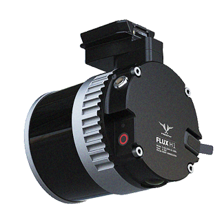
The Flux H1 delivers precise, high-resolution performance with stable, real-time data output, making it well suited for demanding inspection and monitoring applications.
FLUX 01
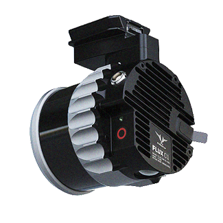
NDAA compliant, the Ouster OS1 is ready to scan your critical infrastructure.
FLUX L1
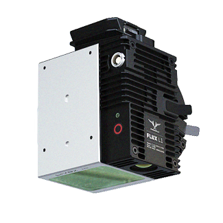
The Flux L1 delivers reliable, high-accuracy performance with consistent signal stability and efficient data acquisition, making it well suited for precision mapping and measurement applications.
LR1 Payload
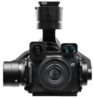
The Sony LR1 delivers high-resolution, low-noise imaging with excellent dynamic range in a compact, lightweight form factor, making it well suited for demanding aerial and industrial imaging applications
Alpha 7R-IV
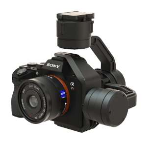
The Sony Alpha 7R IV delivers exceptional high-resolution performance with impressive dynamic range, fast autofocus, and outstanding image detail, making it ideal for demanding professional photography and aerial imaging applications.
Ventus OGI
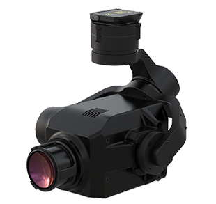
The Ventus OGI delivers high-sensitivity optical gas imaging performance, enabling rapid, accurate detection and visualization of gas emissions in complex industrial environments.
TrueView 641
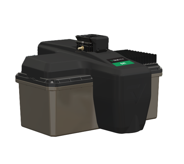
The GeoCue TrueView 641 delivers high-accuracy, survey-grade LiDAR performance with dense point cloud generation while maintaining NDAA compliance for secure government and enterprise applications.