
WISPR systems
Drone platforms for mapping, surveying, construction and power line inspection.
Complimenting the growing demand for above and below ground digital twins, and to provide additional robust geospatial information capability to our customers including licensed surveyors, engineers, geologists, and other natural resource professionals, ImpulseRadar US now offers US made WISPR UAVs supporting multiple payloads and industry leading features.

SkyScout 2
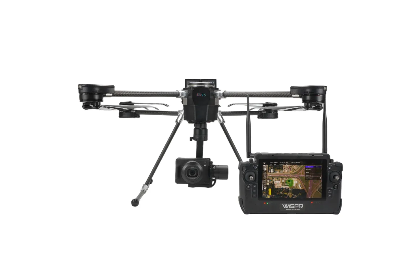
American-Made NDAA-Compliant Precision Aerial Platform
The WISPR SkyScout 2 is a next-generation professional UAV engineered in the United States for demanding industrial, commercial, and government operations. Designed to deliver precision data collection, robust safety systems, and modular payload versatility, SkyScout 2 sets a new standard for mission-critical aerial mapping, surveying, inspection, and public safety workflows.
Payloads
SonyILX-LR161MP

The Sony ILX-LR1 (61MP) for Wispr Systems is a compact, full-frame camera payload engineered for high-precision aerial mapping, inspection, and photogrammetry.
RESEPI GEN-II M2X-IL

LiDAR
The GEN-II payload is an advanced, next-generation, sensor-fusion platform designed for accuracy-focused real-time and post-processed aerial, mobile, and pedestrian-based remote sensing applications