
Pix4D
Professional Mapping & Photogrammetry Software
ix4D is a leading suite of photogrammetry and drone mapping software trusted by surveyors, engineers, construction teams, agriculture professionals, public safety agencies, and GIS specialists around the world. Its tools convert aerial images captured with drones, mobile devices, or terrestrial cameras into high-precision geospatial data products — including orthomosaics, point clouds, 3D models, and more
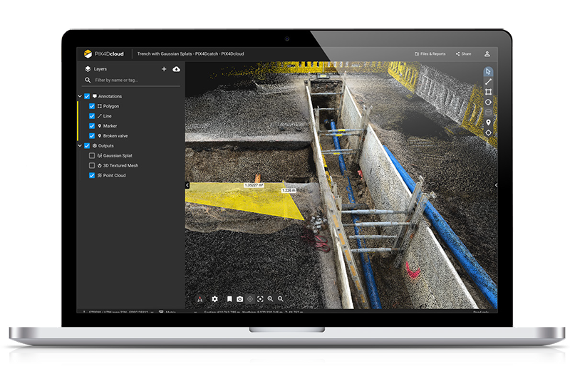
Pix4Dcloud
A powerful online processing and collaboration platform that lets teams upload, process, view, share, and annotate maps and models from any browser — ideal for remote project documentation and stakeholder reporting.
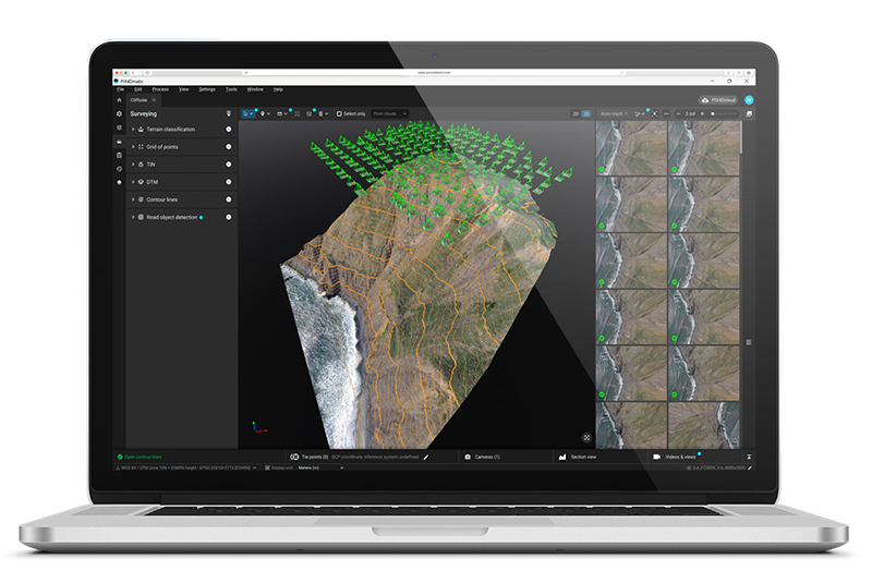
Pix4Dmatic
Next-generation photogrammetry software optimized for fast processing of large datasets, corridor surveys, and terrestrial mapping, delivering accurate point clouds, surfaces, and orthomosaics at speed.
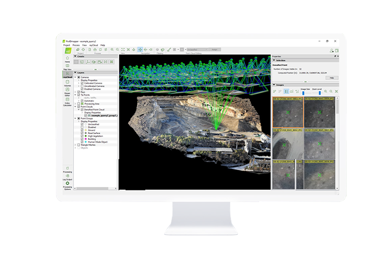
Pix4Dmapper
The core professional photogrammetry platform. It transforms aerial and ground images into highly accurate georeferenced maps and 3D models with survey-grade precision, full control over processing options, and detailed quality reporting
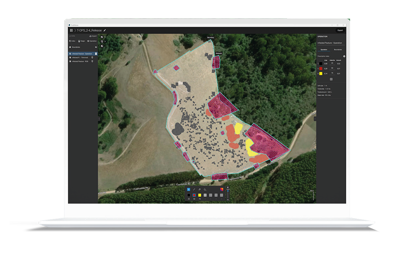
Pix4Dfields
A specialized tool for precision agriculture that processes multispectral and aerial imagery into crop health maps, NDVI and vegetation indices, and actionable field analytics.
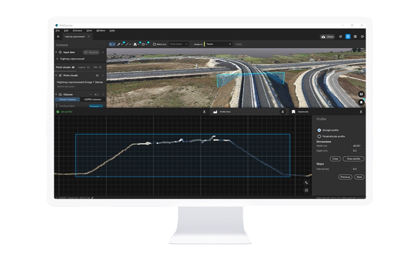
Pix4Dsurvey
Bridges the gap between photogrammetry and CAD — extract vector data, terrain surfaces, and features directly from point clouds and photogrammetric outputs for engineering and GIS use
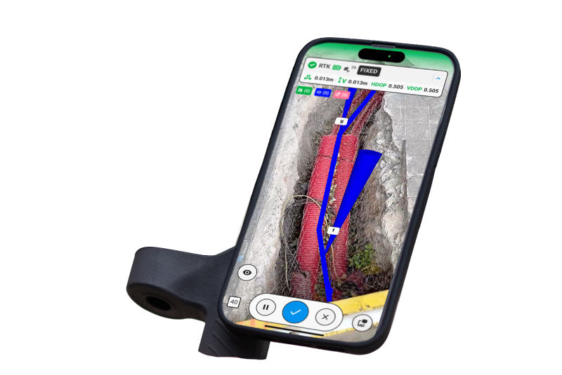
Pix4Dcatch
Mobile and terrestrial capture workflows that turn smartphones and RTK-enabled devices into 3D scanning tools for site documentation, BIM integration, and reality capture.